Groundwater management and conservation for sustainable development for a large resort and golf course in northern India
Geovale has recently completed successfully a groundwater exploitation and conservation project at watershed level. Our highly proficient team of hydrogeologists, geophysicists, civil engineers and agriculturists have mapped the available ground water resource and balance, characterized the aquifer, analysed the micro waterhsed through satellite image processing and geomorphological mapping and recommended the sustainable ways of groundwater exploitation and conservation.
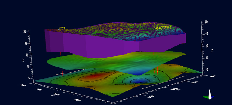
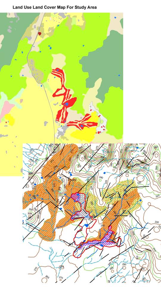
The prefeasibility level work and implementation at ground level have been executed based on geological and geomorphological mapping, remote sensing application to assess the entire hydrological regime, watershed analysis, detailed geophysical investigation – VES and Electrologging, pumping test, aquifer characterization and exploitation scheduling, numerical groundwater flow modeling, detailed topographical survey by Total Station and RTK to locate the best locations for intervention structures, technical audit of existing interventions and recommendations for improvement at local-regional-waterhsed level for the property as well as the community.

Quick Links
